120 Turkish districts under 'double jeopardy' from climate change
A joint analysis by E3G and Boğaziçi University's climate research group iklimBU mapped 973 districts in Türkiye along the axis of climate and socioeconomic vulnerability: 65 of the 120 most at-risk districts are in Southeastern Anatolia.
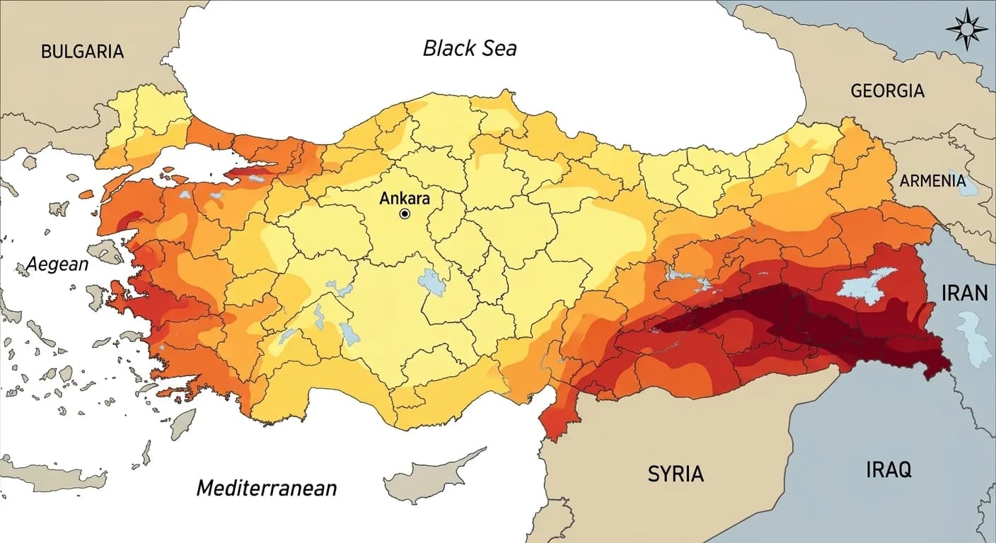
Of Türkiye's 973 districts, 120 face both the threat of high temperatures and lack the socioeconomic capacity to cope with this situation. A joint study by E3G and Boğaziçi University's Climate Change and Policies Application and Research Center (iklimBU) has mapped these districts for the first time.
According to the analysis, 65 of the 120 districts in the highest risk group are located in the Southeastern Anatolia Region. Districts in Şanlıurfa, Mardin, and Diyarbakır, which are heavily reliant on agriculture, top the list. The socioeconomic vulnerability index was created using data from the Ministry of Industry and Technology's SEGE-2022.
For the climate hazard analysis, CMIP6 global climate models were used, and high-emission scenarios for the 2021-2050 period were studied. This shows the regions where the temperature increase will be felt most in the next 30 years.
Although major cities like Istanbul and Ankara face a high risk of extreme heat, these cities are not included in the 'double risk' list. The reason is high adaptability: air conditioning use, access to healthcare, and income levels reduce the risk in these areas.
This map shows that combating climate change is not just about reducing emissions, but also about fighting poverty. Türkiye's poorest districts are the most vulnerable to heat waves. Given the extreme temperature records experienced in the summer of 2024, these regions urgently need intervention.
This article was produced with the assistance of AI tools and reviewed by an editor before publication.